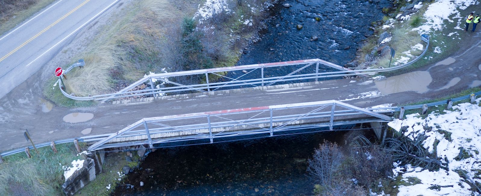
Lewis and Clark National Forest-Historic Bridge Inspection
Pathfinder was approached by the Lewis and Clark National Forest to document a historic bridge prior to its removal. Pathfinder used its drone capability to produce quality photography and a 3D model of the bridge prior to its removal. The products served as a mitigation to the adverse effect of removing the historic bridge and the 3D model provided a to scale model of the bridge available in perpetuity.
Hungry Horse Reservoir - Archaeological Site Mapping
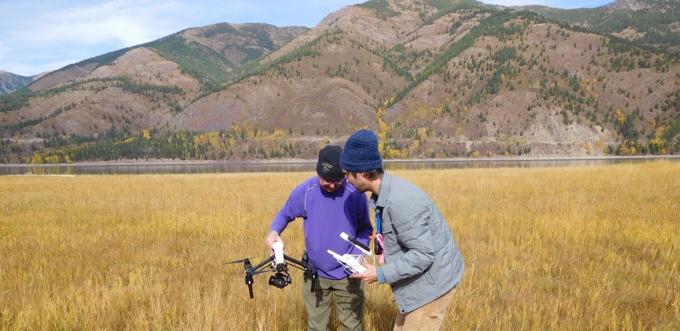
In 2017, the Bonneville Power Administration contracted with Pathfinder to map archaeological sites on Hungry Horse Reservoir. Their goal was to gather spatial data on these sites that would show areas in the site being heavily impacted by erosion and to provide high resolution imagery that will serve as a benchmark for future comparison as reservoir erosion continues. It is part of broader efforts by the BPA to be stewards of the heritage resources they manage. Pathfinder was able to successfully deliver the required products.
Koocanusa Reservoir - Erosion Monitoring Mapping
The Kootenai National Forest in NW Montana hired Pathfinder to map select erosion monitoring stations along Koocanusa Reservoir. The goal was to provide baseline data, in the form of high resolution aerial imagery and a digital surface model, for monitoring erosion going forward. Previously, they had used rebar stakes in the ground and measured to the shoreline to track erosion. With UAS data, they will be able to quantify the volume of erosion taking place from year to year and be able to clearly visualize changes to the shoreline with high resolution aerial imagery. The project is ongoing but was successful for the first phase.
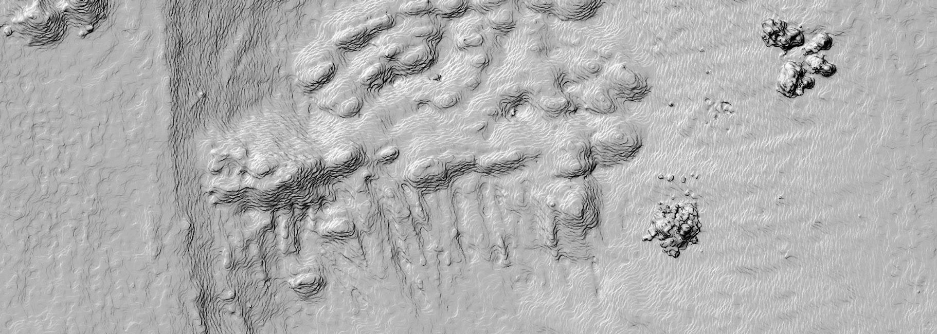
California Creek Quarry - Archaeological Quarry Mapping
Alex Schwab conducted an intensive aerial survey of a prominent archaeological quarry in Montana for his Masters Thesis. Alex created a digital surface model and high resolution aerial image of the entire 150 acre quarry. Through spatial analysis, the volume of material removed from the quarry was calculated from a cut-fill analysis. The results reinforce the conclusion that the area has significant regional prominence in the indigenous history of Montana.